![]()
Paseo del Lobo (Path of the Wolf)
A Wolf Awareness campaign along the path of natural dispersal from the Blue Range Wolf Recovery Area to the Grand Canyon
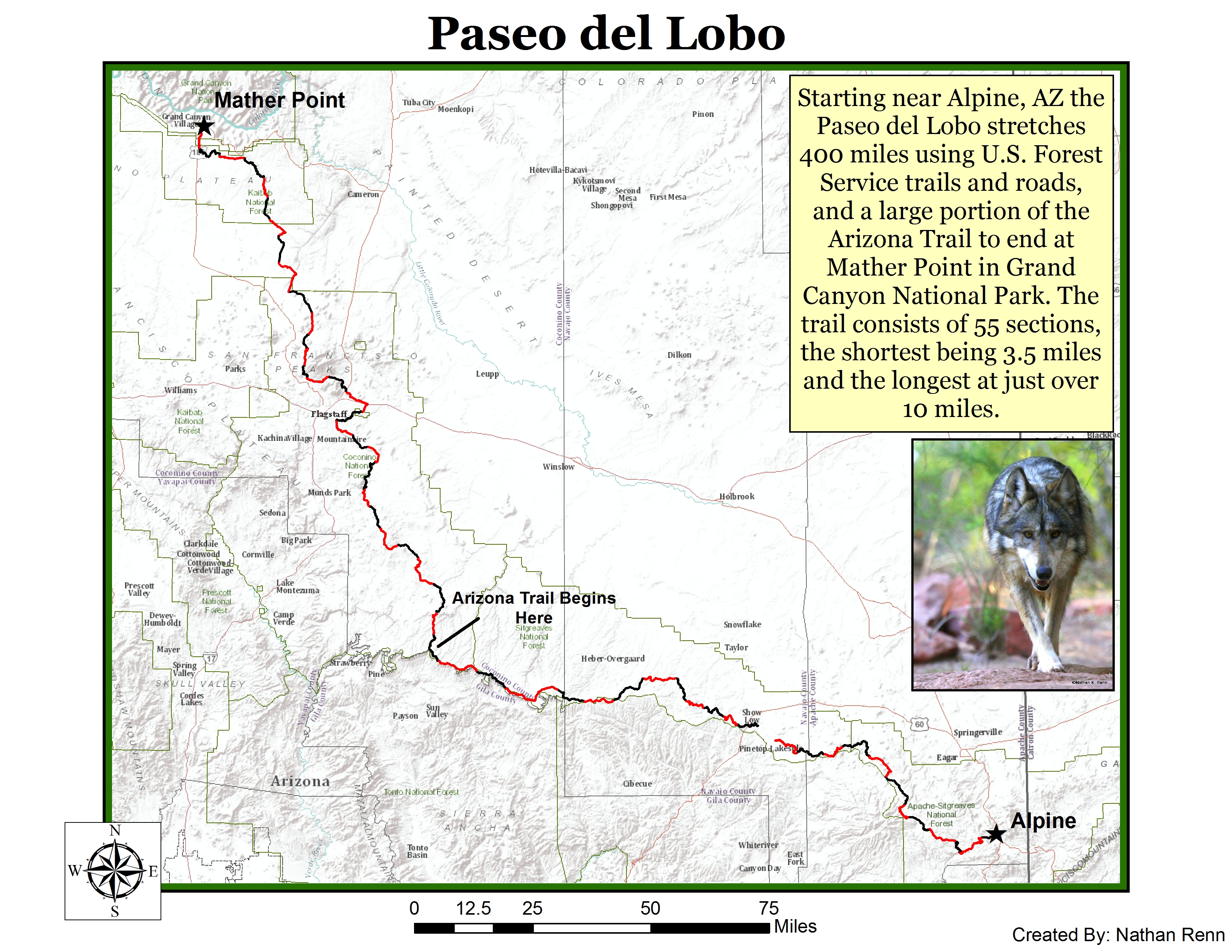 The Grand Canyon Wolf Recovery Project is excited to host our wolf advocacy campaign annual camping trips and hikes each year that follow a natural dispersal corridor, connecting the Blue Range Wolf Recovery Area (where Mexican gray wolves currently live) to the South Rim of the Grand Canyon (where we are advocating for their return). Mexican wolves are capable of traversing hundreds of miles, and need room to roam in order to establish a metapopulation structure to preserve remaining genetic diversity.
At least six wolves have been documented dispersing to the Flagstaff area since the initial release of Mexican wolves into Arizona in 1998. In 2000, a female Mexican wolf wandered northward, eventually traveling over 200 miles until a vehicle struck and killed her just twelve miles north of Flagstaff on US Highway 89. In 2001, federal and state wildlife agencies reported that a radio-collared, yearling male lobo traveled from his reintroduction site in the Apache National Forest to the Mormon Lake vicinity on the Coconino National Forest south of Flagstaff. The agency biologists later tracked him moving south to Clear Creek and then eastward along the Mogollon Rim headwaters. It is possible he was following the scent of the female wolf who traveled this route before him, seeking out a mate he would never find. Our sojourner was shot and illegally killed in early 2002. As a community awareness event, the Paseo del Lobo hike offers participants a unique opportunity to learn more about little-known stories like this, as well as current efforts to help critically-endangered wolves make their way back to the wild.
We know wolves will follow the forested higher elevations of the Mogollon Rim region northward to the Coconino and Kaibab National Forests of the Grand Canyon region if they are allowed to do so. Teams of volunteer hikers (and mountain bikers in select sections of the route) will trace a path of dispersal along an important wildlife corridor on national forest land over 400 miles that these two wolves traveled and future wolves might journey, and document conditions along the way. Hikers will share their direct experiences of suitable wolf country in the Grand Canyon region to online followers though video diaries, blog posts, photographs, and updates posted on social media and this website.
Our Big Lake Howliday Campout Weekend and other outreach events in conjunction with the hike are held at least one weekend each summer - please stay tuned for more details as they are posted! Events will highlight current status and plight of Mexican wolves in Arizona, the rule that prohibits their establishment of territories wholly outside the recovery area and the adjoining Fort Apache Indian Reservation, conditions and dangers (such as roads) that wolves might face along the way, and the suitability of wolf recovery in the Grand Canyon region.
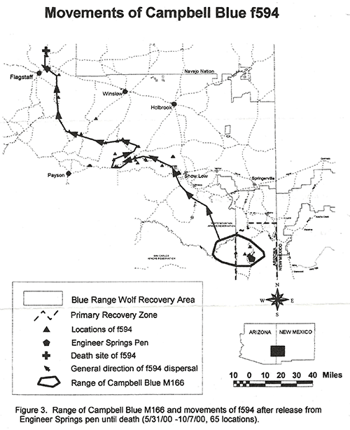
Map from the Mexican Wolf Reintroduction Annual Report 3, Reporting Period:
January 1 - December 31, 2000. Mexican Wolf Interagency Field Team.
Copy courtesy of Jean Ossorio.